Srieves Survey - 8 December 1794 - Transcribed by Gail M. Walczyk
Spelling remains the same.
December 8th 1794 Surveyed at the request of William Srieves Nine Acres of land which the sd Sreaves hat lately purchased of Edwd Kilman which lands lie in the parish and Coutny of Accomack and bounded as follows (towit) On the S. E by the lands of the aforsd Sreaves on the S. W by the lands of Thos Rileys heirs on the N. W by the lands of Thos Gray late of Edwd Kilman and on the N. E by the heirs of Solomon Gray for the Courses Distances Plat and other particulars below Parker Barnes AS. AC
lines
Courses
Distances
Boundaries
AB
12.37W
07.00
new pine
BC
N60W
07.33
Piner Corner
CD
S39W
25.00
Corner at Joynes's
DE
S30E
10.80
Danl Bull corner
EF
Nh7E
12.00
FA
N52E
16.50
to B. Gum at beginning
Click the thumbnail for
an image of the survey
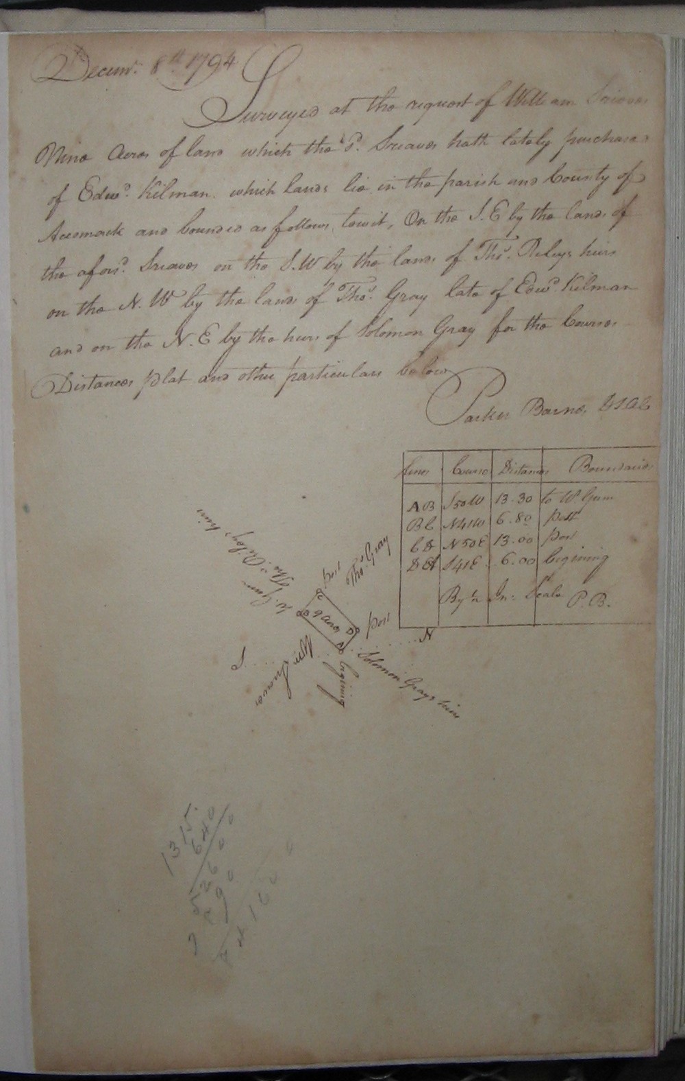
Sources:
_____. Accomack County Virginia Surveyors Records #2 1794-1799, No Page Number.