Bradford Survey of 27 & 28 May 1792 - Transcribed by Gail M. Walczyk
Spelling remains the same
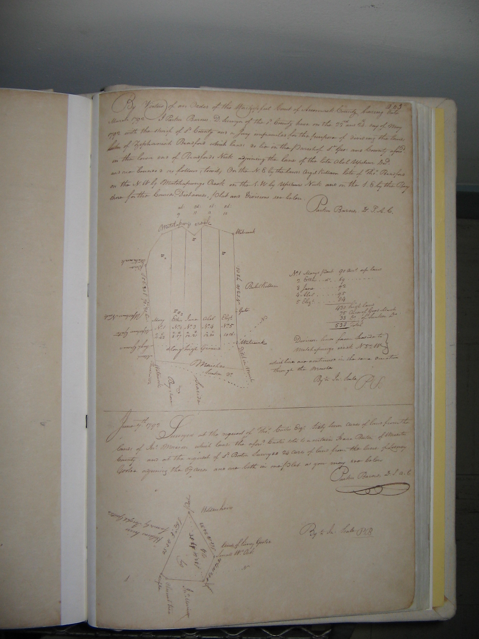
By
virtue of an Order of the Worshipful Court of Accomack County bearing date March
1892 - I Parker Barnes D. Surveyor of the sd County have on the 27th and 28th day
of May 1792 with the sherif of sd County and a Jury impaneled for the purpose of
dividing the land of Zephaniah Bradford which land do lie in the Parish of St. Geo.
and County aforsd in the lower end of Bradfords Neck adjoining the lands of the late
Abel Upshur Decd and are bounded as follows (towit) On the N. E. By the lands Argil
Kellam late of Thos Bradford on the N. W. by Matchapungo Creek on the S. W. by Upshur
Neck and on the S. E. by the Bay shore for the Courses, Distances, Plat and Divisions
see below.
Parker Barnes D. S. A. S.
No 1 Mary's part . . . . . 90 acrs
up land
No 2 Esther do . . . . . . 69 . . . . . . . . . .
No 3 Jane
do . . . . . . . 92 . . . . . . . . . .
No 4 Abel do . . . . . . . 95 . .
. . . . . . . .
No 5 Elizb do . . . . . . . 84 . . . . . . . . . .
. .
. . . . . . . 430 high land
. . . . . . . . . . 75 Acres Good Marsh
. . . .
. . . . . . 33 Do of Sunken Do
Total . . . . . 538
Click the thumbnail
for the image |
 |
Source:
_____. Accomack County Plat Book I, p. 205
© Copyright 2011 by Gail M. Walczyk