Floyd Survey 5& 6 July 1843 - Transcribed by W. L. Stith
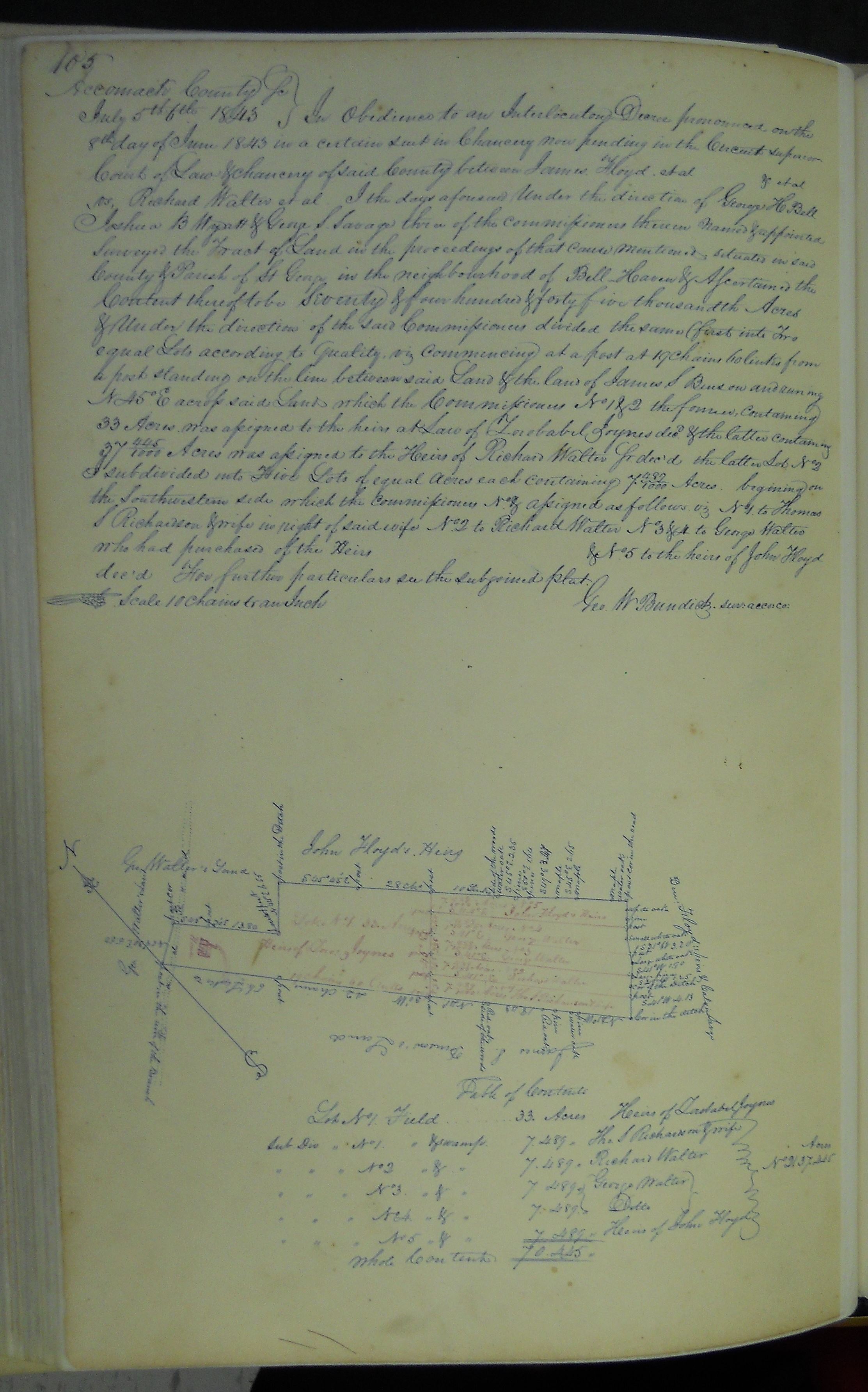
Accomack County Sc July 5th 6th 1843
In Obedience to an Interlocutory Decree
pronounced on the 8th day of June 1843 in a certain Suit now pending in the Circuit
Superior Court of Law & Chancery of said County between James Floyd. et al & et
al vs, Richard Walter et al. I the days aforesaid Under the direction of George H
Bell Joshua B Wyatt & George S Savage three of the Commissioners therein Named &
appointed Surveyed the Tract of Land in the proceedings of that Cause mentioned,
situated in said County & Parish of St George in the neighborhood of Bell Haven &
Ascertained the Content thereof to be Seventy & four hundred & forty five thousandth
Acres & Under the direction of the said Commissioners divided the same ( first into
Two equal Lots according to Quality, viz Commencing at a post at 19 Chains 60 links
from a post standing on the line between said Land & the land of James S Benson and
runing N 45 E across said Land which the Commissioners No 1 & 2 the former, Containing
33 Acres, was assigned to the heirs at Law of Zorobabel Joynes decd. & the latter
Containing 37 445/1000 Acres was assigned to the Heirs of Richard Walter Sr dec'd
the latter Lot No 2 I subdivided into Five Lots of equal Acres each Containing 7
897/1000 Acres. begining on the Southwestern side which the Commissioners No & assigned
as follows viz No 1 to Thomas S Richardson & wife in right of said wife No 2 to
Richard Walter No 3 & 4 to George Walter who had purchased of the Heirs
& No 5 to the heirs of John Floyd dec'd For further particulars see the subjoined
plat. Scale 10 Chains to an Inch Geo. W Bundick. Sur. Acco. Co.
Click the thumbnail for the image:
Sources:
_____. Accomack County Virginia Surveyors Records #6 1832-1873, p. 105.